Digital Geology of Any Complexity

RN-GEOSIM is a modern software product for 3D geological modeling and analysis of hydrocarbon deposits. It provides a wide range of functionalities to solve the most complex geological modeling tasks.

Software versions for Windows and Linux are availableInformation on the software price and purchase conditions will be provided upon requestListed in the Unified Register of Russian Programs for Electronic Computers and Databases
RN-GEOSIM - Digital Geology of Any Complexity

Description

RN-GEOSIM is a modern software product for 3D geological modeling and analysis of hydrocarbon deposits. It provides a wide range of functionalities to solve the most complex geological modeling tasks. RN-GEOSIM offers a wide range of capabilities to tackle the most challenging geological modeling cases.

What's new

RN-GEOSIM is regularly updated: new operations are added, the interface is improved.

In April 2023, it is planned to release RN-GEOSIM 2.0 - a system for collective geological modeling. It includes:

  • replenishment of the local knowledge library for modeling;
  • building a structural framework related to the ability to set the adaptive density of the computational (tetrahedral) grid in the area of markers, faults, initial data density;
  • spatial interpolation of data in terms of facies and petrophysical modeling on grids with faults, taking into account plicative deformations and disjunctive dislocations.
02.05.2024 Version

02.05.2024 Version

We added:

  • General: the user name and date of task description change can now be saved to the project file; scrolling is added into in task windows
  • Project tree: an object can now be focused in the project tree
  • Import: the universal trajectory and marker loader is improved; more features of trajectory import; import of perforations, cores and PLT; import of maps in cps3 format and import in rescue format are fixed
  • Import from RN-KIN: import of perforations, cumulative production and status of wells from the RN-KIN database
  • Correlation window: it is now possible to swap logging and depth tracks using drag-and-drop
  • Section window: displaying well trajectories and values on the legend is fixed; it is now possible to display the zoom scale
  • Wells: focusing on the well in visualization windows
  • Attributes: calculation of TVT and TST attributes for markers that have more than one value on one well is modified
  • Points: features for creating points by an attribute
  • Logging: an error of saving changes in the table view of logging values is fixed
  • Maps: compression (filtering) of spatial data to speed up calculations
  • Interactive editing: new map editing tools, a new tool for drawing isolines in the 3D window; hotkey tooltips are added onto the edit panel
  • Tectonic frame: interpolation of faults using the gridless method in cases where well trajectory points belong to a certain fault wing, interpolation of data that allows for an error in passing near the fault, and data that is not included in the area of creating the structural model; an error of tectonic frame creating is fixed
  • Structural model: an error of constructing a multilayer model and a horizon with erosion is fixed
  • Grids: a new option “Compress thin cells” when creating a grid from the 2D structural model; it is now possible to transfer parameters accounting for differences in geometry and parameters with index binding in the grid stitching features; compression (filtering) of spatial data (wells, well logging, points) using embedded algorithms
  • Upscales: it is now possible to specify a reference curve when rescaling logging; working with upscales as a separate data type; simultaneous display of a new type of cubes (upscales) and other cubes (discrete and continuous)
  • Modeling: errors in facies modeling accounting for UVT and interpolation using Kriging are corrected in petrophysical modeling
  • Cubes: the upscale cube can be selected in the module for lithology cube selecting for the pay zone map
  • Analytical maps: mapping of average oil saturation with distribution by zones
  • New storage: an error of opening projects with a large grid is fixed; the project can be restored from change history
  • Operations: the operation tree mode with temporary or permanent blocking of objects and operations; the operation results can now be saved in the selected group; a user comment can be entered for each task; tree view of the task list is added
  • Help: help on standardization of logging curves, the pivot table of attributes for well log interpretation results and saturation settings is updated
12.22.2023 Version

12.22.2023 Version

We added:

  • General: errors of copying a geomodel and its objects (polygons, maps and contours) are fixed
  • Seismics: batch import of 2D seismic data; procedures for “intersection” of a horizon and a fault are fixed; T-D transformation module is added for data cubes
  • Interface: new contextual tabs for the activity feed; incorrect scaling of some windows is fixed; no more errors of displaying the number of child elements after deletion
  • New storage: errors are fixed; changes can now be cancelled; the panel for viewing the list of changes is added
  • Import: the universal marker loader is improved
  • Import form RN-KIN: importing curves of well log/well log interpretation results is fixed
  • Project tree: markers and curves of well log/well log interpretation results are copied during well copying
  • Group tree: it is now possible to import data to the group tree; custom sorting of data in the group tree is implemented
  • Interactive editing: new tools to edit polygons and maps
  • Markers: an error of inserting multiple rows into an empty table is fixed; no more errors of updating the marker table
  • Polygons: dividing a polygon by an acute angle is now correct
  • Maps: no more map calculator errors when the map is rotated; errors of reading values ​​from the map are fixed
  • Grids: new features of grid stitching; no more errors of grid construction from the structural model; thin cell compression prototype for grids from structural models is implemented
  • Cubes: errors of the fault block cube creation and recalculation are fixed
  • Modeling: local update errors are fixed
  • Tectonic frame: errors of tectonic 3D frame construction are fixed; it is now possible to set fault covariance radius
  • Analytical maps: the logic of work in the case of 3D cube missing values ​​is changed
  • 3D window: visualization errors during operations with maps in the calculator are fixed
  • Section window: the palette can now be moved; displaying the intersection of polygons with a profile
  • Well data correlation window: drag-and-drop mechanism to drag tracks (including the domain track); new fill patterns for logging curves
  • Statistics: cube statistics errors are fixed
  • Neural networks: the features for well data interpretation using neural networks is returned
  • Help: description of the grid stitching module is added; description of new tools for editing points, polygons and maps is added; descriptions of operations with points and polygons and general description are updated
  • Training videos: construction of analytical maps; interactive fault relationship setting; selection of lithology cube for the net pay map; correlation; interactive data editing; model update
12.15.2022 Version

12.15.2022 Version

We added:

  • automatic filling of stratigraphic horizons based on imported data when importing markers;
  • the ability to edit options and set of modeling template operations;
  • workflow_templates folder, from which modeling templates will be automatically imported into all geomodels;
  • well weights when calculating logging statistics;
  • automatic resizing of isoline captions when zooming the 2D window;
  • the ability to apply captions to various types of sections in the 2D window;
  • the ability to use various pictures to visualize marker icons in the 2D window;
  • creating multiple sets of icons for well characteristics;
  • the ability to color points visualized in the 2D window using a palette, according to the specified attribute;
  • setting the diameter of points when they are visualized in the 2D window;
  • setting the wellbore line thickness when it is visualized in the 2D window;
  • the ability to interactively set the relations of faults;
  • adapting the structural 3D modeling widget to the new unified stratigraphic model;
  • selecting active zones for generating the grid using the structural 2D model;
  • SNESIM library acceleration;
  • training image creation operation.

Benefits

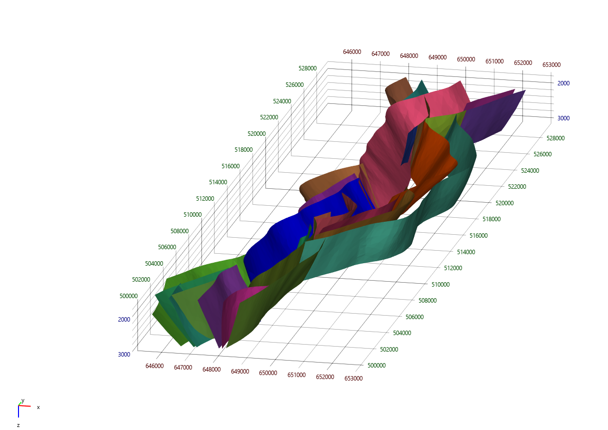
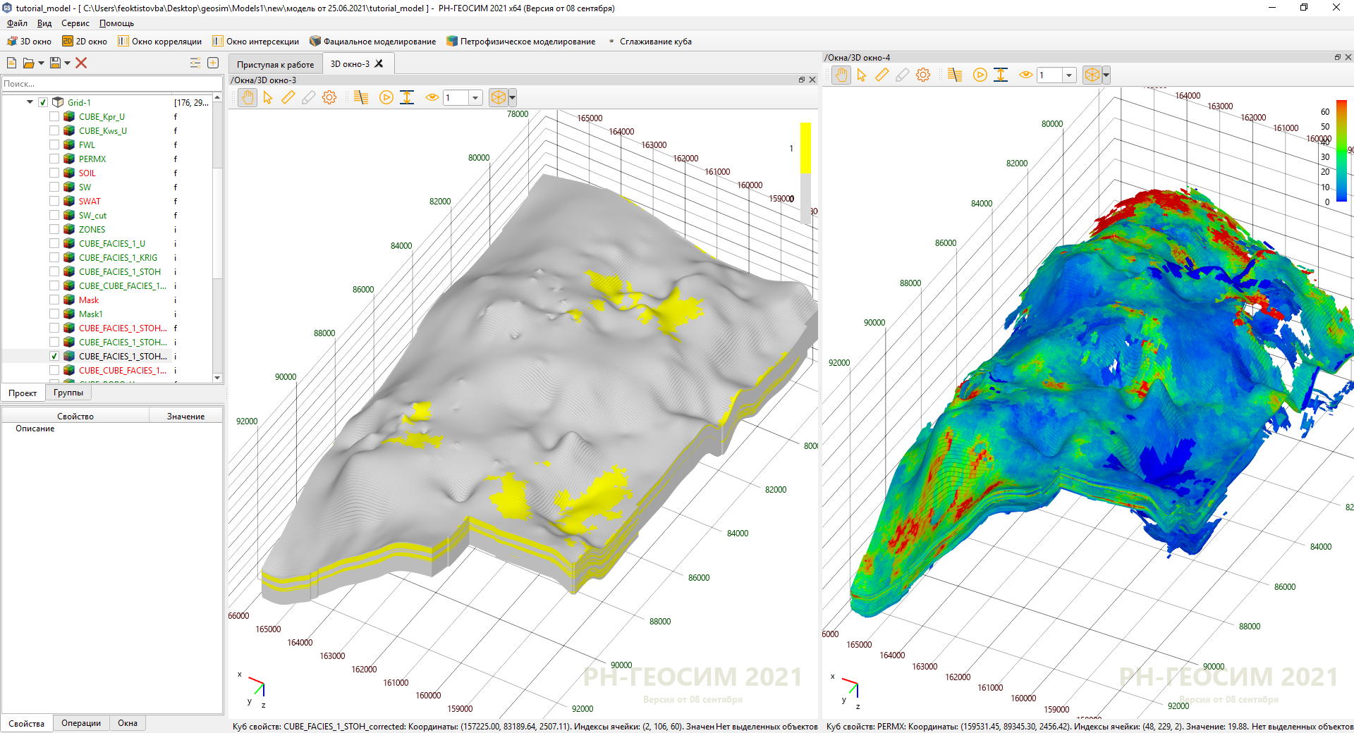
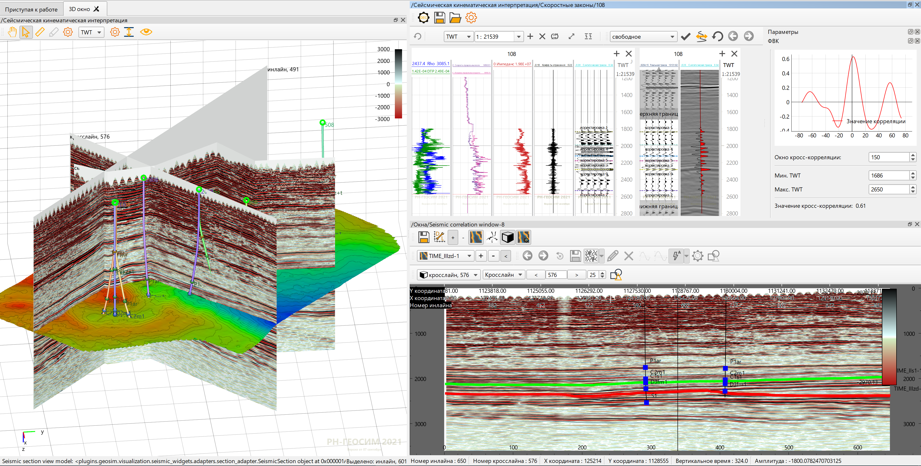
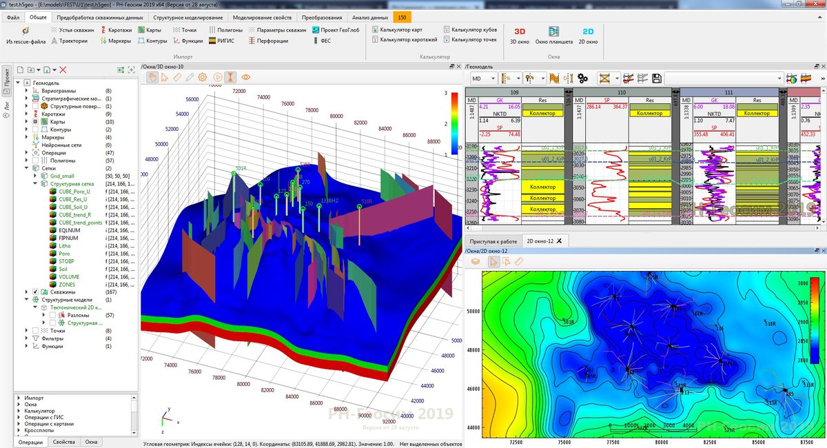
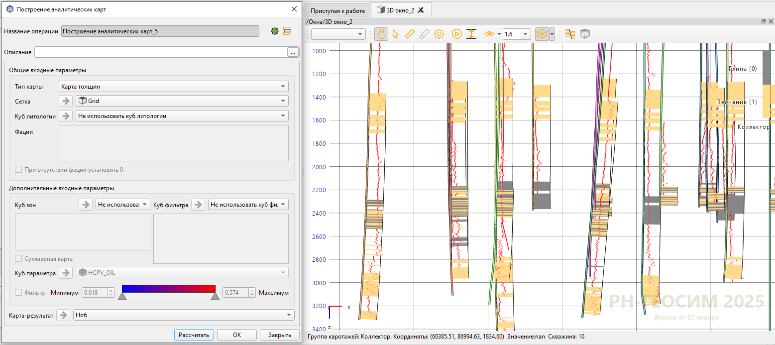
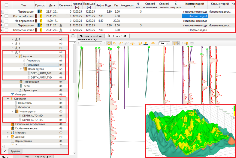
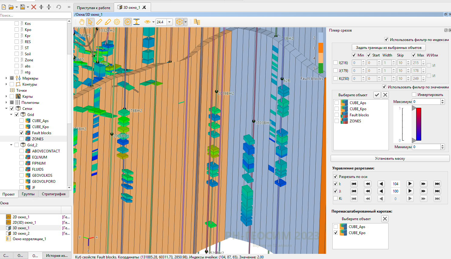
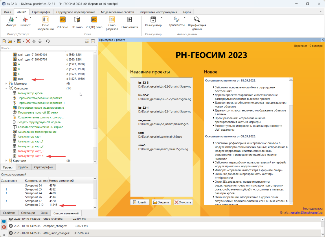
RN-GEOSIM is an integrated multi-user platform for geological modeling which allows to create full-scale geological models.

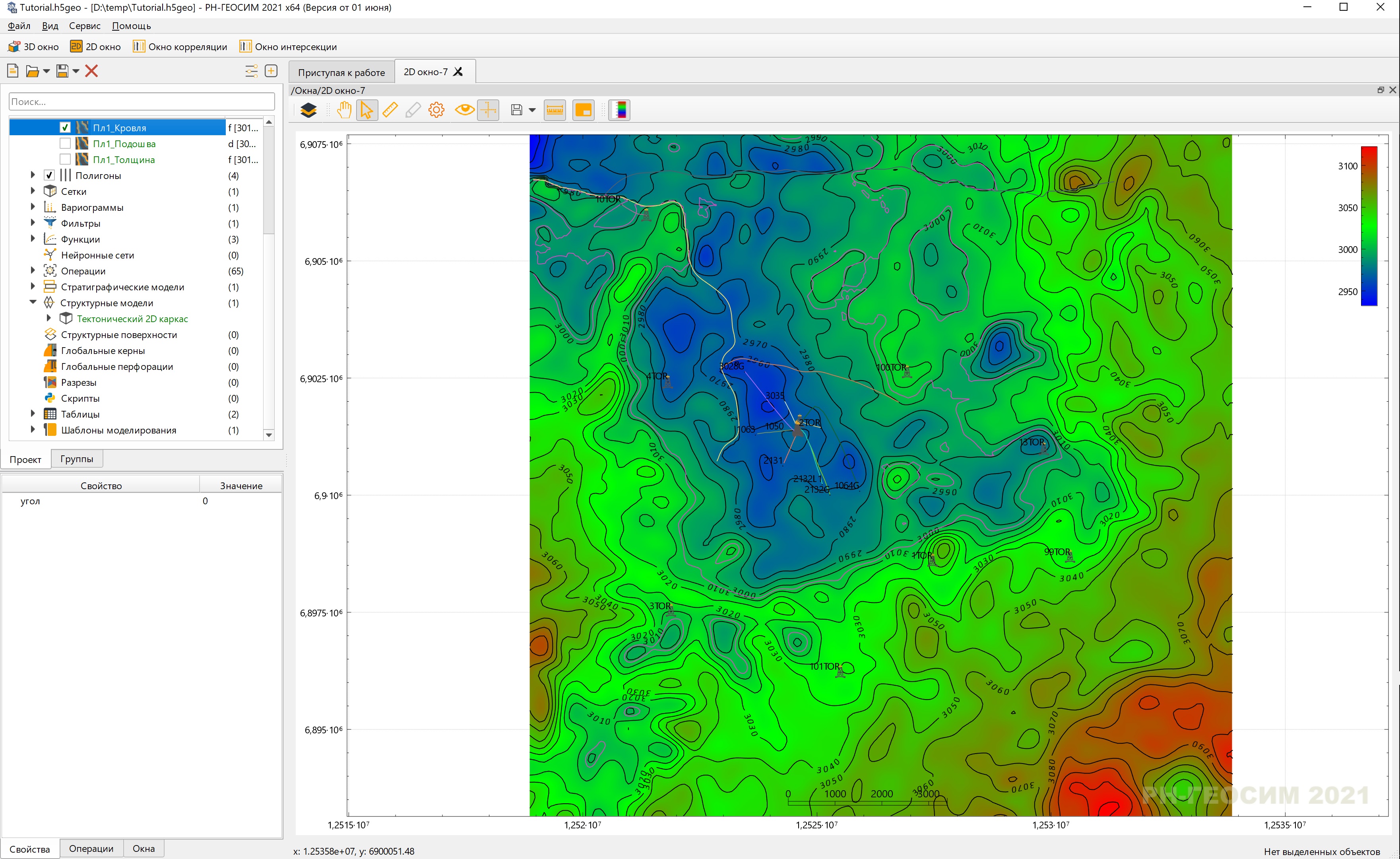
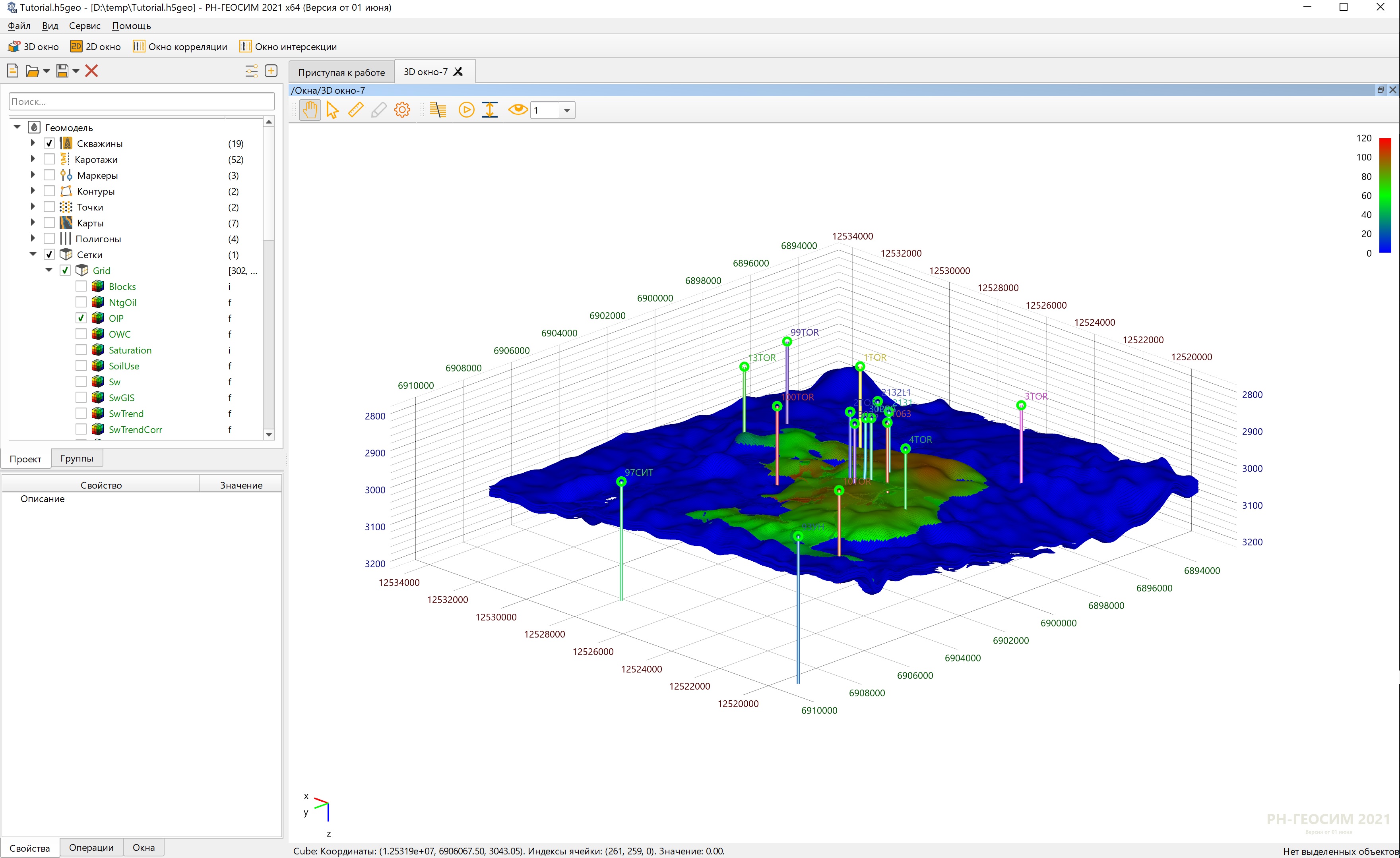
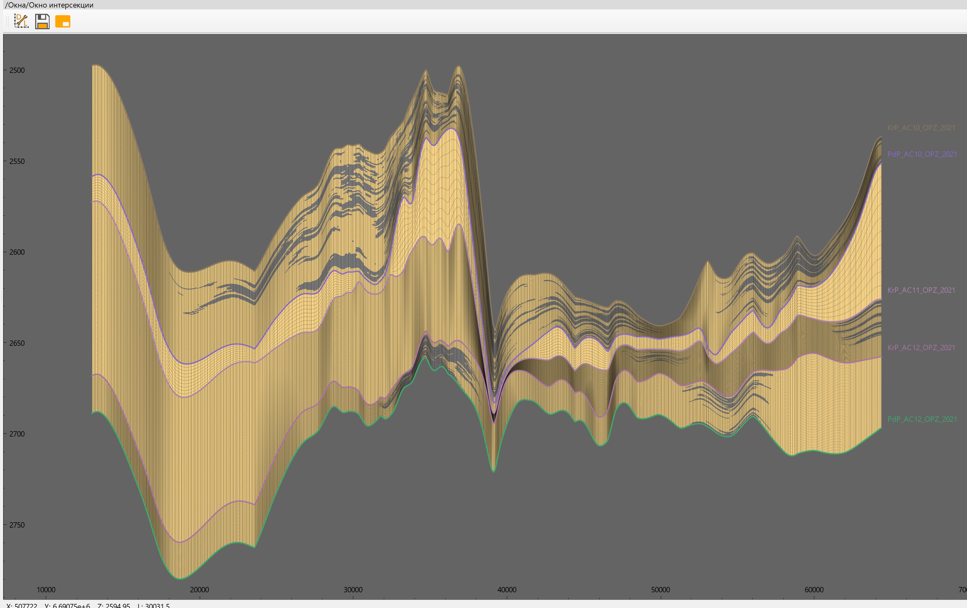
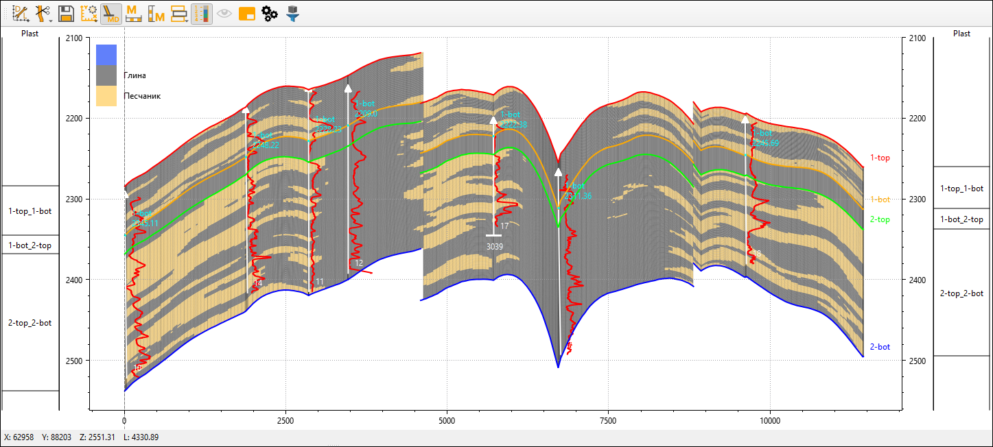
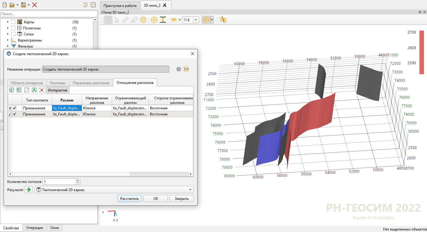
It contains modern visualization tools representing the components of the geological model in 1D (correlation scheme), 2D and 3D projections.

A full set of geomodeling tools
“Seismic and hydrodynamics for geologists” within one project
High-performance computing
Universal any-fault modeling
All-known and unconventional geostatistics algorithms
Automatic workflow creation
3 click update of the geological model
Object modeling and multipoint statistics
Importing data of arbitrary formats
Additional tools for well log/well log interpretation results curves
Certified by the State Commission on Mineral Reserves
Listed in the Unified Register of Russian Software
Linux version is available

Solving Problems of Any Complexity

RN-GEOSIM offers a full range of geomodeling tools: interactive visualization, data import and data management, well section correlation, structural and fault modeling, facies and petrophysical 3D modeling, reserves calculation, graphics reporting.

Interactive Well Correlation Tool

Interactive Well Correlation Tool

Interactive 2D Visualization Tool

Interactive 2D Visualization Tool

...displaying information in reporting formats

...displaying information in reporting formats

Interactive 3D Visualization Tool

Interactive 3D Visualization Tool

...displaying an arbitrary model section

...displaying an arbitrary model section

Structural Modeling Tools

Structural Modeling Tools

Facies and Petrophysical Modeling Tools

Facies and Petrophysical Modeling Tools

Tools for Kinematic Interpretation of Seismic Data

Tools for Kinematic Interpretation of Seismic Data

Plans

Plans for 2023-2025:

RN-GEOSIM 3.0 is a system for solving production tasks of oil and gas exploration.

  • Support for large and extra-large models

    • Quick managing of large datasets
    • Working with maps and surfaces over large areas
    • Multilayer projects
    • Adaptation of RN-GEOSIM for working with regional models
  • Tectonic modeling

    • Accounting for inaccurate fault data
    • Meshless interpolation algorithms
    • Quick calculation of tectonics
  • Support for complex MultiZ structural models

    • Adaptive grids
    • Optimization of algorithms for super-multilayer structural models
  • Analysis of model stability to new data

    • Stability assessment of 2D and 3D models to changes
  • Quality control and expert review of models

    • A set of modules for geological model expert review
    • Automated reporting on the expert review results
    • Setting of model quality criteria
  • Geologist's digital advisor

    • Automatic model checks during creation
    • Notifications when check/checks are not completed
    • Integration of geologist’s advisor with the user’s manual
  • Interactive training

    • Training cases of various complexity
    • System of “achievements” in RN-GEOSIM based on the results of training scenarios
  • Basin modeling

  • Focus on usability when solving specific production tasks